Vector Data
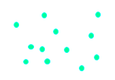
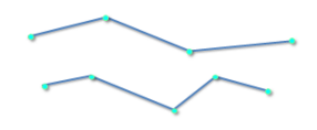
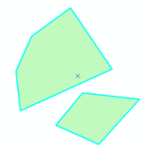
By recording the coordinates and spatial relationships of spatial objects, Vector Data structure can accurately represent the spatial locations of geographical entities such as points, lines and polygons. In the Vector Data structure, point data can be directly described by coordinate values, line data can be described by uniformly or unevenly spaced sequential coordinate chains, and surface data can be expressed by closed polygons composed of multiple arc segments.
 |
 |
 |
| Figure 1: Points | Figure 2: Lines | Figure 3: Polygons |
Vector Data structure is a kind of data organization that uses points, lines, surfaces and their combinations in Euclidean geometry to represent the spatial distribution of geographical entities. This data organization can best approach the spatial distribution characteristics of geographic entities, with high data accuracy and low redundancy of Data Save, which is convenient for Network Analysis of geographic entities, but it is difficult for Overlay Analysis of multi-layer Spatial Data.
Vector Data can be obtained in the following ways:
- Field survey: survey results can be automatically recorded by surveying instruments (total station, theodolite, GPS, etc.), and then transferred to the geographic database.
- Map digitization: refers to the conversion of maps on traditional paper or other materials into computer-recognizable graphic data, mainly including tracking digitization and scanning digitization.
- Raster Data Conversion: Convert Raster Data to Vector Data using Raster Data vectorization technology.
- Data analysis: New Vector Data can be generated through operations such as overlay and Buffer Zone Analysis in Spatial Analysis.
Vector Data is often used in urban zoning or detailed planning, land management, utility management, etc.


