Instructions for use
SuperMap provides four Measure Distance methods:
" Spatial Distance": Applicable to the distance between objects with a certain elevation in the scene, this function will calculate the Spatial Distance between the start point and the end point based on their spatial positions.
" Terrain Distance": Distance Measure is performed on the terrain in the scene. This function can calculate the surface distance of the surface relief according to the automatic attachment of the terrain to the surface.
" Horizontal Distance": When there is Terrain Data or Model Data in the scene, this function can calculate the Horizontal Distance between the start point and the end point based on their positions.
" By object distance": When there is OSGB Data or Model Data in the scene, this function can calculate the distance between the start point and the end point and the Model Data.
Operation steps
The operation modes of the three kinds of measurement are similar. In this paper, the "Spatial Distance" measurement operation is taken as an example:
- First, set the distance unit used in Distance Measure. Set the distance unit through Unit in the Measurement group in the Scenario tab. The default unit is meter.
- Click the Drop-down Button of the Distance item in the Measurement group of the Scene tab, and select Spatial Distance from the pop-up drop-down menu.
- Move Stop by Mouse to the Scene. When the mouse status changes to a red dot, you can perform a Distance Measure on the surface of the earth in the scene.
- Click the left mouse button at an appropriate position on the earth's surface to determine the starting point of measurement and calculation. At this time, move the mouse, and a temporary line with a constantly changing length connecting the current point of the mouse and the starting point will appear on the screen. At the same time, the measurement and calculation results will also be displayed. Numerical value: There are two numerical values in the measurement and calculation process: "current length", namely, the distance value between the current mouse point and the previous mouse point; "total length", namely, the total length of the measurement and calculation path determined between the current mouse point and the start point of the measurement and calculation.
- Click the left mouse button continuously to determine the other points of the measurement, and leave the measurement path composed of the determined points on the surface of the earth. At the same time, the distance value of the determined measurement path between two adjacent points is displayed.
- End Distance Measure and click the right mouse button. The value notes of the current length and the total length will appear at the corresponding position of the length measurement. The value of the length measurement will also be displayed in the Output Window.
- Click the " Clear" button in the " Measurement" group to clear the numerical annotation of length measurement in the current Scene.
- When multiple measurement and calculation paths are drawn in Scene, if you only want to clear some of the records, you can click the Click to delete button in the Measurement and calculation group, and click the annotation on the measurement and calculation path to clear the path and annotation of the current length measurement and calculation.
- If you need to continue with the Distance Measure, repeat steps 1 through 8.
Comparison and difference of result
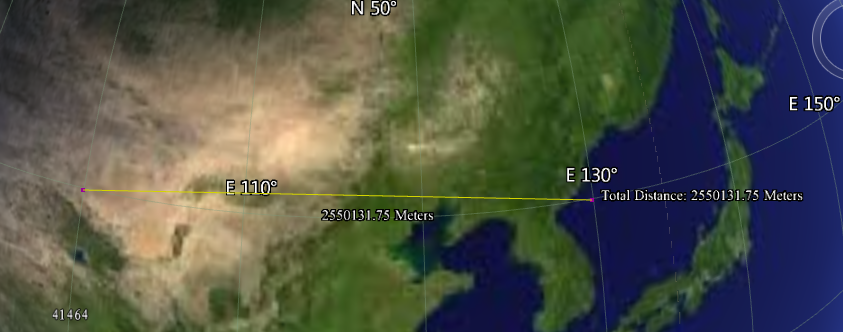
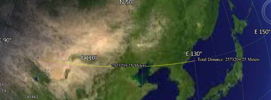
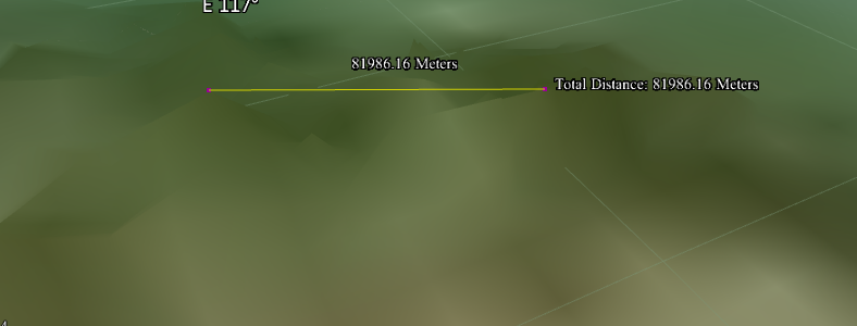
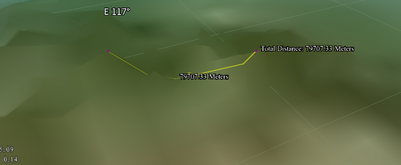
| Scene data | Measurement and calculation method | Measure and calculate the results | Example of results |
| No Terrain Data | Spatial Distance | The Spatial Straight-line Distance of the Smooth Earth without Considering the Relief of the Earth's Surface |
|
| Terrain Distance | The space spherical distance of the smooth earth without considering the topographic relief of the earth's surface |
|
|
| There is Terrain Data | Spatial Distance | In the process of measurement, the measured distance is the spatial Straight-line Distance according to the terrain elevation. |
|
| Terrain Distance | In the process of measurement, the measured distance is the curve distance according to the topographic relief. |
|
 Precautions
- Measure Distance in the scene. It can only be measured on the Earth Surface. In other areas of the Scene outside the Earth, Distance Measure is invalid.
- If there is no Terrain Data in the measured area, the measured distance is the spherical distance of the smooth sphere, that is, the spherical distance of the smooth earth without considering the topographic relief of the earth's surface.


