Feature Description
build geological body function allows creating a geological shape model based on multiple geological point datasets (geographic coordinate system or projected coordinate system). It enables rapid modeling and visualization of complex geological bodies and can be effectively used for geological survey analysis.
Function Entry
- 3D Data tab -> Models group -> Geological Body drop-down menu -> Build Geological Body
Operation Steps
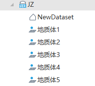
- In the Workspace Manager, right-click on "Data Source" and select "Open File Datasource" to open a datasource containing geological point datasets. It can also include region datasets representing layer bounds. Sample data sources are as follows:
- Click the 3D Data tab, then the Models group, and select Build Geological Body from the Geologic Body drop-down button. The "Building a Geological Shape" dialog box will pop up.
- Add source geological point datasets:
- Use the toolbar in the dialog to add source datasets, select all source datasets, invert selection, remove selected datasets, and sort datasets (move to top, move up, move down, move to bottom). In building a geological shape, the order of point layers corresponds to the actual stratigraphy from high to low. After importing datasets, use the sort datasets tool to adjust the sequence.
- Geological Type: Set the geological type for the corresponding source dataset, such as sand, clay, etc. After setting, configure through material parameters.
- Attribute Query Condition: Used to query data meeting specific conditions from existing point datasets for participation in building a geological body. Click the button on the right to pop up the "SQL Expression" dialog box. For parameters in the "SQL Expression" dialog box, refer to Querying with SQL Statements.
- Result range settings: Used to set the data scope, including default range and select range.
- Default Range: By default, the default range is used, meaning all geological point data participate in the build geological body operation.
- Select Range: Select the datasource and region dataset representing the scope. The selected dataset must have the same coordinate system as the geological point dataset.
-
If the spatial range of the selected region dataset is smaller than that of all geological point data, only geological point data within the region dataset's spatial range will participate in the build operation.
-
If the spatial range of the selected region dataset is larger than that of all geological point data, all geological point data will participate, but interpolation will not occur outside the geological point data's spatial range.
-
- Material parameters:
- Material Info: If geological types are set, click the material info button to pop up the edit material dialog box for setting material info for different geological layers.
- Material Object: Select the geological type set in the source data list and use the following parameters to set material info for different geological types.
- Material Settings: Set color information for the specified geological type data, including name and material color. After selecting the radio button before the material color parameter, set the material color via the color panel. Colors (RGBA) are represented in hexadecimal values, e.g., blue is #0000FFFF.
- Texture Settings: Set the texture for the specified geological type data. After selecting the radio button before the texture map parameter, set the texture map (*.png/*.jpg/*.jpeg/*.bmp) using the open button on the right.
- Texture Repeat: Set the texture repeat mode and horizontal/vertical texture size. When the repeat mode is real size, sizes are in meters, and textures repeat per specified size. When repeat mode is repeat times, sizes are in times, and textures repeat the specified number of times.
- Check the color checkbox and select the desired color scheme from the drop-down list box. Color and material info are mutually exclusive; set parameters reasonably based on needs.
- Material Info: If geological types are set, click the material info button to pop up the edit material dialog box for setting material info for different geological layers.
- Result data settings: Set the datasource and dataset for storing the result model data.
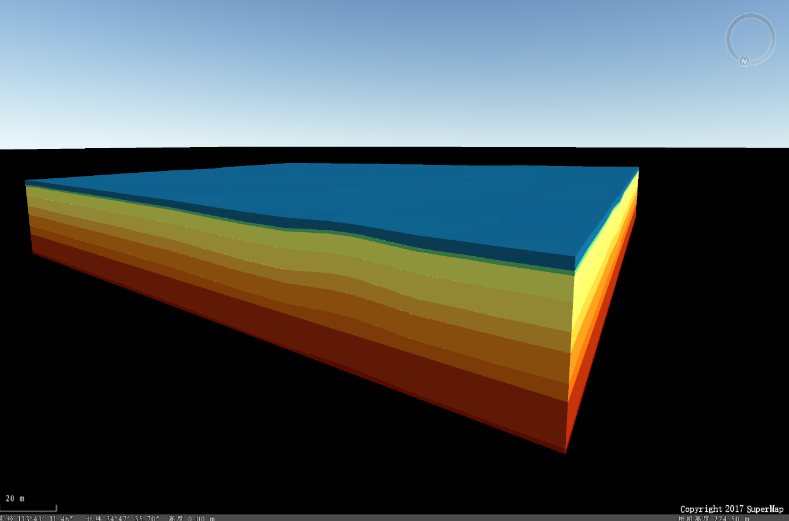
- After setting parameters, click "OK" to build the geological body. The sample build result is as follows: