


Boolean Operation
Instructions for use
The Boolean Operation "function is to perform difference operation or merge operation on TIN Terrain and Model Data in the scene to obtain new TIN Terrain data.
Currently, only the Boolean Operation of a single model is supported.
Operation steps
- Load the Data source. Datasource needs to contain Model Dataest and TIN Terrain data. The demonstration in Add to Scene looks like this:
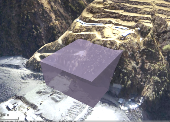
Figure: TIN Terrain and Model Data demonstration effect - Opens the Boolean Operation window. On the 3D Geographic Design tab, under TIN Operation, click the Boolean Operation "button to display the Boolean Operation dialog box.
- Add with the
 button or pick with the
  button a Model Object that performs a Boolean Operation with TIN Terrain from the Model Data loaded in the current scene. After selection, you can delete the Model Data or edit the "Layer Name" and "Model ID" to edit the Model Object involved in the operation through
  the button.
 - Select the Boolean Operation operation. Boolean Operation includes subtraction and consolidation. It is a single-selection Boolean operation.
- Click "OK" to perform Boolean Operation. The operation result of Sample Data difference is as follows: of Difference Boolean Operation Result
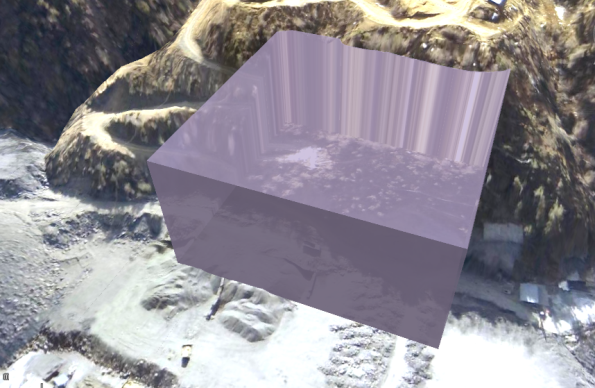
Figure: Effect Diagram
Notice
- Models participating in Boolean Operation and TIN Terrain's Units should be consistent. If not, the operation fails and "Please confirm whether the units of the Target Coordinate System are consistent" will be displayed in the Output Window.