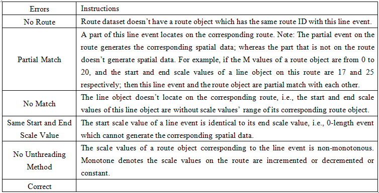
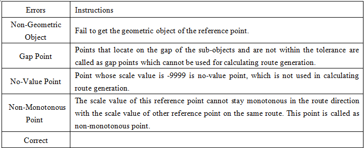
Introduction to Errors Field
Feature Description
The errors field is directly written into the event table, primarily used to describe errors where events failed to generate corresponding points/lines.
During spatial data generation, several common errors may prevent successful location. If the errors field generation is enabled, the application will automatically add this field to the event table and record error information after spatial data generation.
- When generating point spatial data, possible errors include:
- When generating line spatial data, possible errors include: