


Vector To Raster
Feature Description
Convert the vector dataset to the raster dataset.
Function Entry
- Spatial Analysis tab -> Raster Analysis group -> Vector-Raster Conversion -> Vector to Raster.
- Toolbox -> Raster Analysis -> Vector-Raster Conversion -> Vector to Raster.
Parameter Description
- Source Data
- Datasource: Lists all data sources in the current workspace. Select the data source containing the vector dataset to be rasterized.
- Dataset: Lists all vector datasets in the selected data source. Select the vector dataset to be rasterized. It will automatically locate to the dataset selected in the workspace manager.
- Grid Value Field: Lists all fields in the source dataset. Select a field value as the cell value of the result dataset. Note: The value range of the grid value field must match the pixel format, i.e., the range of raster field values must be within the storage range of the result dataset's pixel format. Once the raster field value exceeds the storage range of the result dataset's "pixel format", the raster value of the corresponding cell will be set to 0. For example, when the "pixel format" is set to "4-bit", its storage range is [0,15], a total of 16 integers. If a field value is 20 (exceeding the storage range of the 4-bit pixel format), the raster cell value corresponding to that field value will be set to 0.
- Result Data
- Datasource: Lists all data sources in the current workspace. Select the data source for the result dataset. Default is the same as the source data source.
- Dataset: Sets the name of the result dataset. The result dataset is a raster dataset (GRID).
- Parameters
- Bounds Data Source: Lists all data sources in the current workspace. Select the data source containing the border dataset.
- Border Dataset: Select the border dataset. It must be a region dataset. By selecting a border dataset, you can rasterize only the part of the source dataset that intersects with the border dataset.
- Pixel Format: Sets the pixel format of the result dataset. Includes 1-bit, 4-bit, single byte, double byte, integer, long integer, single, double, etc., 8 types in total. Users can select an appropriate pixel format based on actual needs. For detailed description of pixel format, please refer to Raster Dataset Pixel Format.
- Resolution: Sets the resolution of the raster dataset. The smaller the resolution, the more accurate the raster data. The default resolution is calculated as L/500, where L represents the boundary length, taking the value of the larger side between the width (Width) and height (Height) of the result dataset's region range, and 500 represents the default number of cells contained in boundary L. The calculation result is the size of each cell. Additionally, users can adjust the resolution of the result dataset manually. The unit of resolution is the same as the geographic unit of the source dataset.
- Environment Settings: Sets analysis environment parameters. The analysis environment parameters supported by Vector to Raster include the geographical extent of the resulting dataset, clip bounds, default cell size, etc. For specific operations, please refer to the Setting Analysis Environment page.
Note: Environment parameters can be set as global, meaning the parameter values set here will be used as the overall raster environment analyst parameters. Other functions that support environment parameters do not need to set them again. If environment parameters are not set here, the settings of those parameters in the raster analysis environment will be read during analysis.
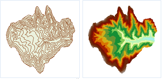 |
| Figure: Contour vector to raster result |