


SuperMap currently provides seven overlay analysis tools. The following are detailed descriptions:
Clip
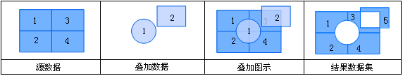
The clip operation extracts partial features from the input dataset using the clip dataset. The polygon set in the clip dataset defines the clipping area. Features in the input dataset outside these polygonal areas will be removed, while those within will be output to the result dataset.
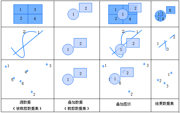 |
| Figure: Schematic Diagram of Clip Operation |
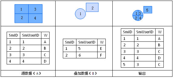
The attribute table of the clip result inherits from the input dataset. Its structure matches the input dataset, retaining all original attribute values except recalculated metrics like area and perimeter. As shown below, all fields from Dataset A are automatically added.
 |
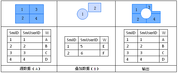
Union (Merge)
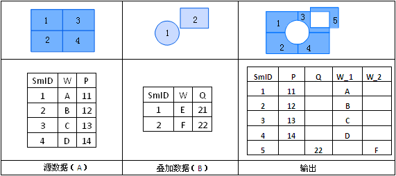
The union operation combines two datasets. After union, intersecting polygons between two region datasets are split, topology is rebuilt, and both geometries and attributes are output to the result dataset.
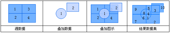 |
| Figure: Schematic Diagram of Union Operation |
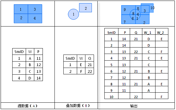
The result's attribute table combines fields from both input datasets. Users can select required fields from Dataset A and B. Current overlay analysis result fields follow the "field_1" and "field_2" pattern as shown:
 |
Erase
The erase operation removes features overlapping with the erase dataset. The erase dataset's polygons define the erase area. Features within these areas are removed, while external features are retained. This operation shares principles with clip but preserves opposite regions.
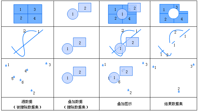 |
| Figure: Schematic Diagram of Erase Operation |
The erase result's attribute table inherits from the input dataset, maintaining the same structure. As shown below, all non-system fields from Dataset A are automatically added:
 |
Intersect
The intersect operation finds overlapping areas between two datasets. Features are split at intersections (except point features).
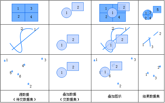 |
| Figure: Schematic Diagram of Intersect Operation |
The result dataset includes attribute fields from both input datasets. Users can select required fields as shown:
 |
Identity
The identity operation maintains the source dataset's extent while incorporating overlay dataset's geometry and attributes. It combines intersection and union operations. For point datasets, all source objects are retained. For line datasets, intersecting lines are split. For region datasets, polygons within the source boundary are preserved while intersecting objects are split.
 |
| Figure: Schematic Diagram of Identity Operation |
The result's attribute table includes non-system fields from both datasets. Users can select fields as needed:
 |
Symmetric Difference (XOR)
The symmetric difference operation retains non-overlapping parts from both datasets. For each polygon, overlapping areas are removed while remaining parts are preserved.
 |
| Figure: Schematic Diagram of Symmetric Difference Operation |
The result's attribute table contains non-system fields from both datasets:
 |
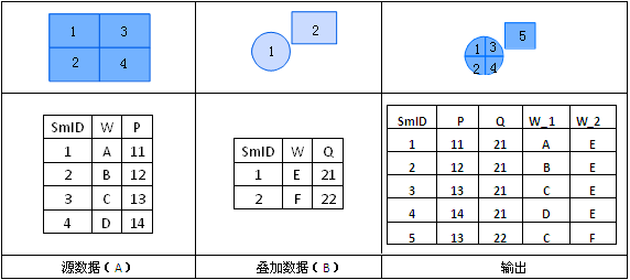
Update
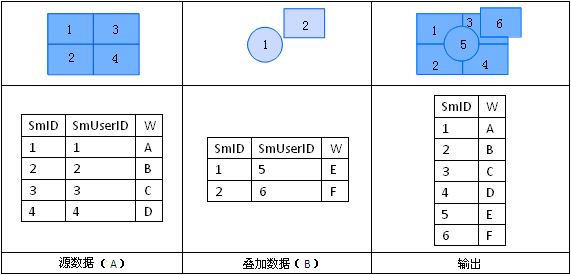
The update operation replaces overlapping areas with the update dataset's features through erase-and-paste process. The result retains the update dataset's geometry and attributes.
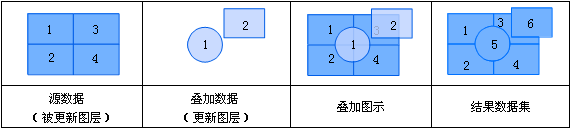 |
| Figure: Schematic Diagram of Update Operation |
In the result's attribute table, overlapping areas adopt Dataset B's attribute values:
 |