Location Analysis
Feature Description
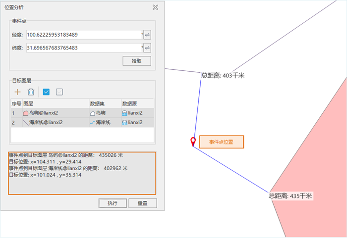
Location analysis is an interactive query based on distance analysis principles, which can calculate the distance from a point to lines or regions. The calculation results will be displayed in both the Location Analysis dialog and the map.
As an interactive query function, location analysis requires the map window to be open before use.
Application Scenarios
During navigation, it's necessary to query the shortest distance from a ship's position to the coast or islands.
Feature Entry
- Spatial Analysis Tab -> Vector Analysis -> Proximity Analysis -> Location Analysis;
- Toolbox -> Vector Analysis Tools -> Proximity Analysis -> Location Analysis;
Parameter Description
- Event Stop:
- Longitude: Displays and sets the longitude of the event point.
- Latitude: Displays and sets the latitude of the event point.
- Pick: Use this button to select event point locations on the map, which can be either point objects or any map location. After successful selection, coordinate information will be returned to longitude and latitude fields.
- Target Layer: Specifies layers for distance queries from the event point. Use the Add button to include target layers. Note: Only line or region datasets currently open in the map can be selected as target layers. Multiple layers can be selected for query.
Search results are displayed as follows: