FME (Feature Manipulate Engine) is a powerful spatial data transformation processing system that integrates over 320 spatial and non-spatial data formats and contains a wealth of data processing transformers. SuperMap iDesktopX leverages the flexible extensibility of GPA to interface with FME, supporting the addition of FME Workbench workspaces (.fmw) to the toolbox. These can be connected with other tools in modeling workflows to easily solve spatial data conversion challenges.
Use Cases
1. Conversion between CAD and GIS Data: For example, in real estate data integration, CAD graphics drawn in the field often have complex layer structures. FME tools can be used to achieve lossless conversion of the required data.
2. Inspect Data Quality: For instance, during the internal processing of the Third National Land Survey data, FME tools can be utilized for node density checks, irregular geometry checks, polyline width checks, checks for adjacent patches with consistent attributes not being merged, and attribute logic validation.
Feature Description
1. Set the FME-Desktop Installation Path: First, ensure that FME-Desktop is installed on the local machine and relevant licenses are obtained (It is recommended to use version 2020.2.5.1-b20828 or above, and only 64-bit versions are supported). The FME installation path can be set using the following two methods:
Add the FME-Desktop installation directory to the system environment variable 'path', then restart SuperMap iDesktopX.
Set the local FME-Desktop installation path via the context menu of the FME group in the SuperMap iDesktopX toolbox. This method requires resetting the directory every time the desktop is restarted to use FME tools.
If the "Add FME Tool" option in the context menu is available, it indicates the path settings are successful.
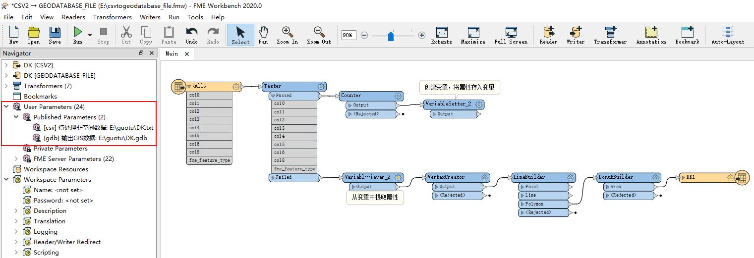
2. Create an FME Tool: Use FME Workbench to create a data conversion workflow and define the parameters to be published, facilitating the connection of the tool and parameter input during GPA modeling.
After building a workflow, such as Converting CSV Data to GDB Data as shown below, set the published parameters, for example, "Input CSV Data Path" and "Output GDB Data Path". Finally, save the created workflow as a workspace (.fmw). Note: Currently, the interfaced FME tools only support English names and paths. It is recommended to use English for published parameter names, workspace save paths, and names.
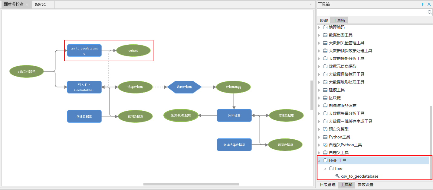
3. Add/Remove FME Tools: In the context menu of the FME group, select "Add FME Tool" or "Remove FME Tool" to add the tool to or remove it from the toolbox. After an FME tool is added to the toolbox, its output value is a Boolean value, where 'true' indicates success and 'false' indicates failure.
4. Use FME Tools: Drag and drop the added tool onto the canvas to connect and use it with other tools in modeling.
In a polygon overlap check model, the land parcel polygon data is in a specific CSV format used in the business, and existing tools cannot read it. The added FME tool can be used to convert the CSV data to GDB data. First, drag the added "csv_to_geodatabase" tool onto the canvas. Since its output is a Boolean value, connect it to the "Import FileGDB" tool as a precondition. Next, create a string-type variable to store the file path, save the conversion result into this variable, and then connect this variable to the "Import FileGDB" tool. This imports the converted GDB file into the data source. Finally, iterate over the dataset and perform a topology check.