


Point Group Regionalization
Feature Description
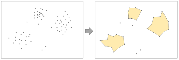
Points regionalization refers to obtaining a polygon feature dataset based on the area covered by aggregated point clusters (with no less than 3 points), which is a common function in cartographic generalization.
Parameter description
| Parameter Name | Default Value | parameter interpretation | parameter type |
|---|---|---|---|
| source dataset | The vector dataset to be calculated, which must be a point dataset. | DatasetVector | |
| target datasource | The specified datasource for storing the result region dataset. | Datasource | |
| the name of the resulting dataset | The specified name for the resulting dataset. | String | |
| aggregation bound distance | This means that two point features will aggregate only within the specified aggregation distance, and the value range is greater than 0. | Double | |
| Unit | Meter | The unit of the aggregation distance. When the data is in planar coordinates, GCS units (degrees, minutes, seconds, etc.) are not supported. | Unit |
Output Result
| Parameter Name | parameter interpretation | parameter type |
|---|---|---|
| Point Group Regionalization Result | result region dataset | DatasetVector |