Feature Description
Perform GeoSOT-based two-dimensional grid encoding on the dataset. That is, after spatially partitioning the Earth's space based on GeoSOT from the longitude and latitude directions, the grid units on the Earth's surface are assigned corresponding quaternary two-dimensional grid codes. For detailed partitioning and encoding methods, refer to 'Geospatial Grid Encoding Rules_GB_T 40087-2021'.
Parameter Description
| Parameter Name | Default Value | parameter interpretation | parameter type |
|---|---|---|---|
| source dataset | The vector dataset to be encoded, supporting point, line, polygon, 3D point, line, polygon, and model dataset types. Only datasets with geographic coordinate systems are supported. | DatasetVector | |
| Two-dimensional position code word segment name (optional) |
GeoSOT_2D_Code | The specified field name for storing the two-dimensional grid position code, which must not exist in the source data. | String |
Output Result
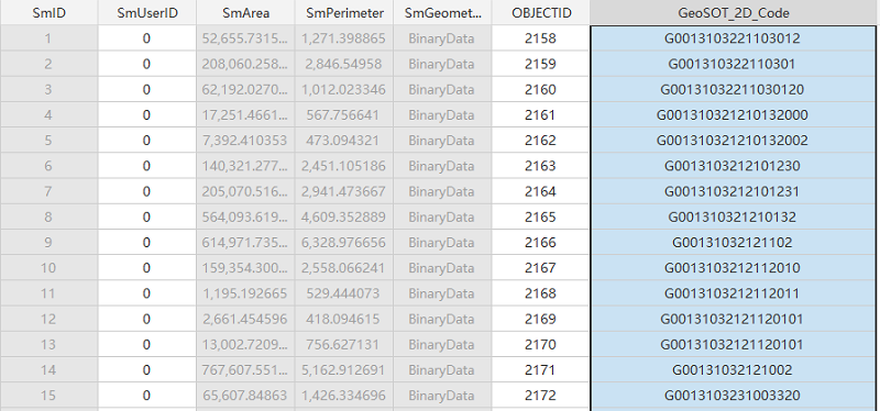
If executed successfully, a new field "GeoSOT_2D_Code" is added to the source dataset to store the quaternary two-dimensional grid position code for the Earth's surface space.
The quaternary encoding of GeoSOT grids starts with G, and the subsequent encoding digits represent the minimum grid partitioning level that completely encloses the geometry in the dataset.
For example:
Two-dimensional spatial code: G00131331010 The encoding result indicates that the minimum grid partitioning level that completely encloses the geometry is level 11.