BeiDou 3D Grid Encoding
Feature Description
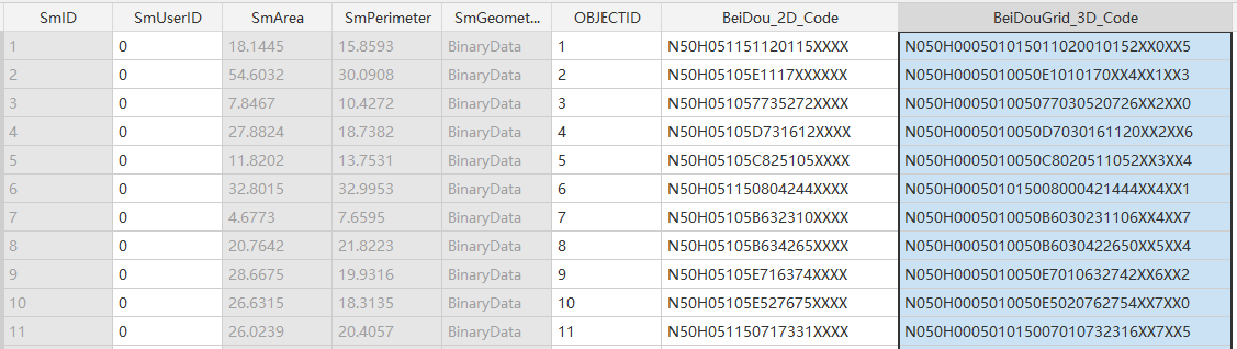
Performs BeiDou 3D grid encoding on datasets. The BeiDou 3D location code consists of BeiDou 2D grid code + vertical grid code. Detailed subdivision and encoding methods refer to the national standard "BeiDou Grid Location Code GB/T 39409-2020".
Parameter Description
| Parameter | Default | Description | Type |
|---|---|---|---|
| Source Dataset | Input vector dataset for encoding. Supports 3D point/line/polygon and model datasets. Only works with geographic coordinate system datasets. | DatasetVector | |
| 3D Code Field Name (Optional) |
BeiDou_3D_Code | Specifies the field name for storing the 3D grid code. This must be a new field not present in the original dataset. | String |
Output
Upon successful execution, adds a "BeiDou_3D_Code" field to the source dataset containing 32-bit BeiDou 3D location codes.