Feature Description
Raster mosaic refers to combining two or more raster datasets into a single raster dataset using geographic coordinates as reference.
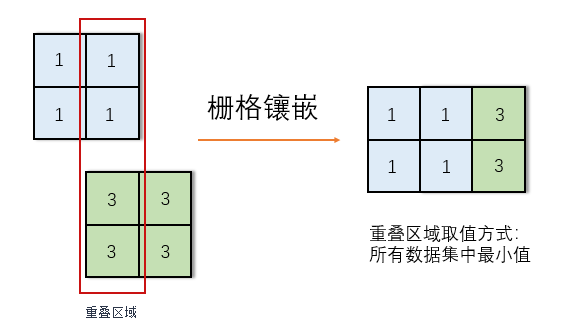
As shown in the figure above, two raster datasets are mosaicked using the same geographic coordinate system. For overlapping areas, the result takes the minimum value from all datasets.
Parameter Description
| Parameter | Default | Description | Type |
|---|---|---|---|
| Raster Datasets to Mosaic | Raster datasets to be mosaicked. Note: All input rasters must share the same coordinate system and have identical number of bands. | Dataset[ ] | |
| Background or NoData Value | -9999 | Background value for image data | Double |
| Background Tolerance | 0 | Tolerance for background/no-data values | Double |
| Overlap Handling | First Dataset's Value | Value selection method for overlapping areas | RasterJoinType |
| Pixel Format of Result | Same as First Dataset | Pixel format of output raster | RasterJoinPixelFormat |
| Resolution | 0 | Cell size of output dataset. Default 0 uses the minimum resolution from input datasets. | Double |
| Output Datasource | Target datasource for results | Datasource | |
| Output Dataset Name | Name for result dataset | String |
Application Scenarios
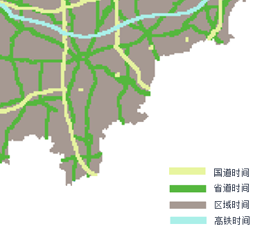
E.g.: Time Cost Calculation
The raster mosaic tool can be used to obtain minimum travel time cost raster for a region. Prepare raster data containing unit-length travel times for national highways, provincial roads, regional areas, and high-speed rail.
Input Data:
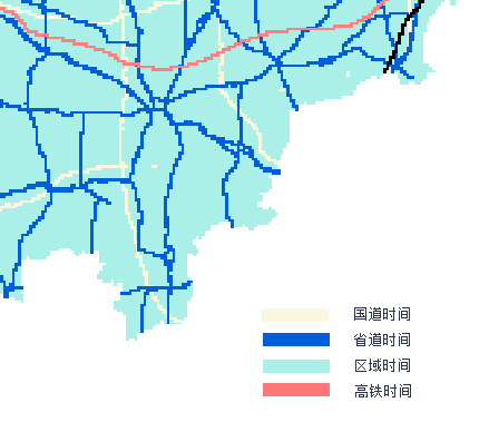
Using the mosaic tool (with overlap handling set to select minimum values from all datasets), calculate the minimum values in overlapping areas. This produces the smallest cost values across all datasets, representing the target time cost.
Result Data: