


Instructions for Use
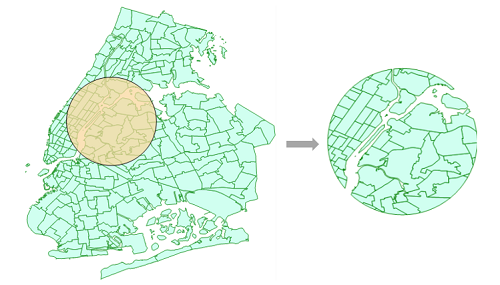
Geometric object cropping uses the input face to crop the dataset. Returns the cropped result feature dataset (FeatureRDD). ! Distributed geometric object cropping provides three functions: regular [geometric object cropping], [multi geometric object cropping], and [DSF geometric object cropping]. The difference is that the input data source is different: Geometric Object Cropping: It can input datasets read from various vector data sources, such as SHP, PostGIS, Oracle, etc; Multiple geometric object cropping: Able to use multiple faces to crop feature datasets; DSF Geometric Object Cropping can only input datasets read from SuperMap DSF data sources. If DSF is used as a distributed analysis data source, it can improve analysis efficiency. The data sources that perform analysis need to have the same geographical partition index, and the operator results output the feature dataset.
Crop Objects
The cropped object for vector data must be a face object and support representation in WKT and GeoJson formats. Among them, the GeoJson format only takes the value part of geometry. The following is an example of filling in the parameters for trimming polygons: |Format | Value| |:-----|:----| |WKT| MULTIPOLYGON(( (119.4568864012999 42.6165414465,119.4946108001999 42.6246252463,119.533682499 42.6246252463,119.5727541978 42.6165414465,119.5875744974 42.5990265471,119.6037420969 42.5842062475,119.634729996 42.5720805479,119.6535921953999 42.55726024829999,119.6657178951 42.5370507489,119.6764962947999 42.4979790501,119.6805381946 42.4791168506,119.6657178951 42.4562127513,119.6441610956999 42.4386978518,119. 6306880961 42.4144464525,119.6293407962 42.39558425309999,119.6387718958999 42.365943654,119.6401191957999 42.3524706544,119.6306880961 42.3349557549,119.6252988963 42.30396785579999,119.6118258967 42.28510565639999,119.5687122979999 42.2783691566,119.5606284981999 42.2783691566,119.5323351989999 42.2904948562,119.5161675994999 42.30262055589999,119.5 42.30935705569999,119.4946108001999 42.330913 85499999,119.5013473 42.34303955469999,119.5255986992 42.35516525429999,119.5296405991 42.3807639535,119.5282932992 42.39019505329999,119.5013473 42.38750045329999,119.4824851004999 42.3928896532,119.4649702009999 42.3969315531,119.4474553015999 42.4063626528,119.4326350019999 42.42791945209999,119.4056890027999 42.44678165159999,119.3800903035999 42.4642965511,119.3558389042999 42.48181145049999 ,119.3585335042 42.4966317501,119.3800903035999 42.51549394949999,119.3962579031 42.5545656484,119.3922160032 42.59767924709999,119.4043417027999 42.6111522467,119.4299404020999 42.6111522467,119.4568864012999 42.6165414465)))| |GeoJson|{"coordinates":[[[[119.45688640130,42.61654144650],[119.49461080020,42.62462524630],[119.5336824990,42.62462524630],[119.57275419780,42.61654144650],[119.58757449740,42.59902654710],[119.60374209690,42.58420624750],[119.6347299960,42.57208054790],[119.65359219540,42.55726024830],[119.66571789510,42.53705074890],[119.67649629480,42.49797905010],[119.68053819460,42.47911685060], [119.66571789510,42.45621275130],[119.64416109570,42.43869785180],[119.63068809610,42.41444645250],[119.62934079620,42.39558425310],[119.63877189590,42.3659436540],[119.64011919580,42.35247065440],[119.63068809610,42.33495575490],[119.62529889630,42.30396785580],[119.61182589670,42.28510565640],[119.5687122980,42.27836915660],[119.56062849820,42.27836915660],[119.5323351990,42.29049485620], [119.51616759950,42.30262055590],[119.50,42.30935705570],[119.49461080020,42.3309138550],[119.50134730,42.34303955470],[119.52559869920,42.35516525430],[119.52964059910,42.38076395350],[119.52829329920,42.39019505330],[119.50134730,42.38750045330],[119.48248510050,42.39288965320],[119.4649702010,42.39693155310],[119.44745530160,42.40636265280],[119.4326350020,42.42791945210], [119.40568900280,42.44678165160],[119.38009030360,42.46429655110],[119.35583890430,42.48181145050],[119.35853350420,42.49663175010],[119.38009030360,42.51549394950],[119.39625790310,42.55456564840],[119.39221600320,42.59767924710],[119.40434170280,42.61115224670],[119.42994040210,42.61115224670],[119.45688640130,42.61654144650]]]],"type":"MultiPolygon"} | Note: During the import and export process of the model, GeoJson formatting will be applied to the clipping polygon parameters, which does not affect the use of the model. You can freely choose to set the clipping polygon parameters in WKT or GeoJson formats.
Parameter Description
Parameter:
|Parameter Name | Default Value | Parameter Definition | Parameter Type|
|:-----|:----|:-------|:----|
|Feature Dataset | | Feature Dataset | FeatureRDD|
|Crop object | | Crop object, must be a face object | Geometry|
Parameters:
|Parameter Name | Default Value | Parameter Definition | Parameter Type|
|:-----|:----|:-------|:----|
|Feature Dataset | | Feature Dataset | FeatureRDD|
|Crop object array
(Optional) | | Crop object array, must be a face object. The query object can be obtained by connecting to the operator 'Big Data Vector Management Basic Processing Get a Geometric Object', or by inputting a string in the format of wkt or geojson| Geometry|
Parameters:
|Parameter Name | Default Value | Parameter Definition | Parameter Type|
|:-----|:----|:-------|:----|
|Geographic Partition Feature Dataset | | Geographic Partition Feature Dataset | DSFFeatureRDD|
|Crop Object | | Crop object, must be a face object. This parameter can be obtained by connecting to the operator 'Big Data Vector Management Basic Processing Get a Geometric Object', or by entering a string in wkt or geojson format| Geometry|