


Feature Description
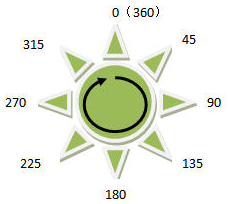
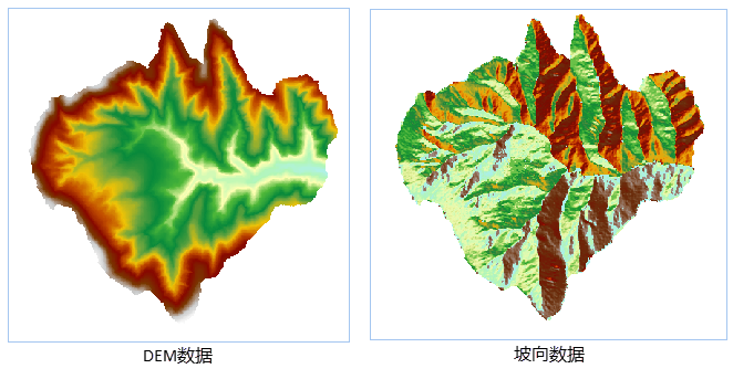
Slope aspect calculation is used to calculate the aspect of each pixel's slope surface in DEM data. The range of slope aspect calculation is from 0 to 360°, starting from due north at 0°, moving clockwise, and ending at due north at 360°. Flat slopes have no direction and are assigned a value of -1. The returned result type is a raster dataset (RasterRDD).
Analysis Principle
The aspect of a point on the ground surface represents the direction of the slope passing through that point. In terrain analysis, aspect denotes the angle between the projection of the normal vector of the tangent plane at that point on the horizontal plane and the due north direction passing through the point. Aspect indicates the direction of maximum change in elevation value at that point.
Aspect is expressed in degrees, and the calculate aspect result ranges from 0 to 360°. Starting from due north at 0°, moving clockwise, and ending at due north at 360°. Each pixel value in the aspect map represents the direction of the slope surface of its pixel. Flat slopes have no direction and are assigned a value of -1.
Since aspect is a circular measure, an aspect of 10° is closer to 360° than 30°. Therefore, before using aspect for data analysis, users need to transform the aspect, i.e., divide it into four basic directions (east, west, south, north) or eight basic directions (east, west, south, north, southeast, southwest, northeast, northwest). This transformation can be accomplished through raster reclassifying functionality to highlight the aspect ranges that need consideration.
Application Scenarios
Aspect holds significant importance in fields such as vegetation analysis and environmental assessment.
- In biology, vegetation growing on north-facing slopes and that on south-facing slopes generally shows distinct differences, primarily due to varying degrees of sunlight exposure required for green plant growth;
- When selecting sites for wind power plant construction, it is necessary to consider building them on slopes facing the wind;
- Geologists often need to understand the main aspect of faults or fold outcrops to analyze geological change processes;
- When determining locations of residential areas vulnerable to damage from snowmelt, south-facing slopes need to be identified to locate the initial melting snow positions.
Parameter description
| Parameter Name | Default Value | parameter interpretation | parameter type |
|---|---|---|---|
| RDD to Analyze | DEM RasterRDD to analyze | RasterRDD |