Update Raster Values
Feature Description
The Update Raster Values feature allows quick modification of local values in raster data through three methods: Single Pick, Select Object, and Draw Bounds.
 Note:
Note:This operation will modify the original data values.
Feature Entry
- Data Tab->Data Processing Group -> Update Raster Values.
Steps
- In the Target Layer dropdown, select the raster data to update.
- Click the Add button to define update scopes. Selected areas will be automatically added to the update list after right-click confirmation. Supported selection methods:
- Single Pick: Select a single cell;
- Select Object: Select one or multiple regions;
- Draw Bounds: Draw an arbitrary polygon area.
- Set update values individually for each scope in the list, or click Uniform Settings to apply consistent values to all selected areas.
- After configuring values, click Run to execute.
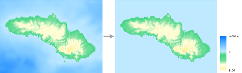
The following figure shows the result of updating values to 0 for areas below sea level in a coastal region: