


Extracting the Longest Flow Path
Usage Instruction
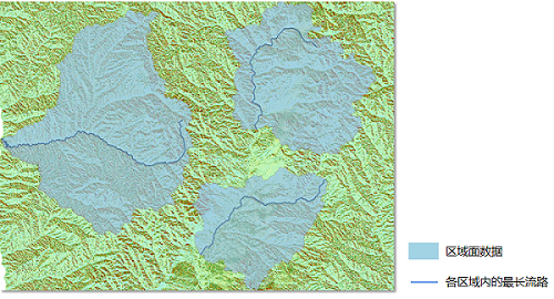
This function traces the longest flow path by inputting an eight-way flow raster dataset and an area surface dataset. The longest flow path of the water system in each region is obtained.
Parameter Instruction
| Parameter Name | Default Value | Parameter Definition | Parameter Type |
|---|---|---|---|
| Flow Data | Select the datasource and dataset where the flow raster is located | DatasetGrid | |
| Regional Surface Data | The specified area surface dataset. | DatasetVector | |
| Region ID Field | The name of the regional surface ID field, which is a unique identifier for the regional surface, can be set to SmID. | String | |
| Target Datasource | The specified datasource where the dataset of the stored results is located | Datasource | |
| Result Dataset Name | Specified result dataset name | String |
Output Result
| Parameter Name | Parameter Definition | Parameter Type |
|---|---|---|
| Resulting waterline dataset | Resulting waterline dataset | DatasetVector |
- The "CatchmentID" field will be created in the result line dataset. This allows the water system line to correspond to the area surface object.