Instructions for use
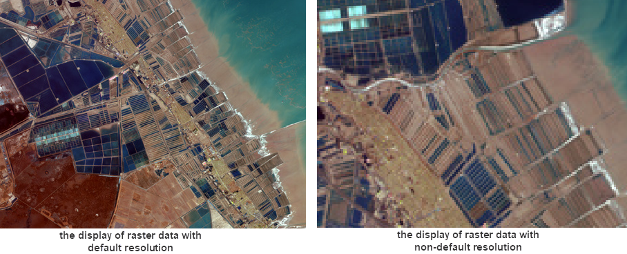
With the Zoom to the image resolution of the layer function, you can adjust the Grid/Image layer to the best Display Status with the clearest Display Effects.
When adjusting, keep the center point of the map unchanged, and adjust the resolution of the Raster Image and the screen resolution to 1:1, that is, one pixel of the screen corresponds to one pixel of the Raster Image data. At this point, if you zoom in further on the Raster Layer, you will not get a clearer Display Effects, but you can see the pixels of the grid. If other Datasets exist on the Current Map, they are displayed at the same resolution.
Operating Instructions: Select a Raster layer in Layer Manager-> right click-> select Zoom to the image resolution of the layer. The map will adjust the Scale Factor according to the resolution of the selected Raster Layer, so that the Display Size of the layer is consistent with its image resolution.