


Map Location
Instructions for use
Map Location can search in the map according to the specified coordinate value, locate a certain position on the map and mark the position of the point with a red dot. At the same time, it can also add coordinate annotation to the point.
Function entrance
- Map-> Browse-> Map Location button.
- Map Location dialog Default Display Center Coordinates of the current Map in units consistent with the current Map coordinates. Enter the coordinate value in the dialog box, click the Locate button, or press the Enter key to locate the Specify Coordinates, and the red identification point is displayed in the current Map.
- If Current Map is Geographic Coordinate System, the default unit of longitude and latitude is degree. Click the Change Coordinates Format To DD, MM, SS button to switch the coordinate input box to DD: MM: SS for setting.
- If the map is a Projected Coordinate System, X/Y coordinates are used for positioning by default. You can select the Use Latitude and longitude Location check box to switch to longitude and latitude coordinates for positioning. Similarly, click the Change Coordinates Format To DD, MM, SS button to switch the coordinate input box to DD: MM: SS for setting.
- If you select the Add Label check box, you can add a position label to the anchor point.
- The positioning and dimensioning results are shown in the following figure:
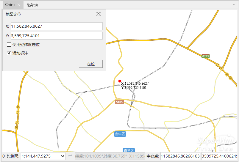
Map Location and Add Label Result
 Precautions
- If the positioning point is not in the current MapVisible Bounds:, the Map will switch to the view display centered on the point after positioning; if the positioning point is in the current MapVisible Bounds:, the current MapVisible Bounds: will remain unchanged after positioning.
- If the current Map does not display the red marker point after positioning, the point shall be shielded by the "Map Location" dialog box, and the user can see the marker point by moving or closing the dialog box.