


SuperMap provides 2D and 3D Plotting technology, which is a technology implemented on the underlying platform of SuperMap. It can build 2D and 3D integrated label library, conveniently and flexibly plot 2D and 3D point labels and Line and Region Symbols. Provide 3D Situation Simulation function. It is mainly used in command and dispatch schemes such as military operation scheme, emergency disposal scheme and public security round-up scheme, and combined with 3D Scene for graphic plotting. By providing all kinds of graphics and model labels with special significance, the disposal scheme of the event can be displayed intuitively and accurately on the 3D Scene, and the efficiency of consultation and communication in the process of event disposal can be improved.
As shown in the figure below, it is a simulated anti-terrorism situation plot with OSGB Data as the background, and a simulated plot of factory fire emergency disposal with Fine Model Data as the background.
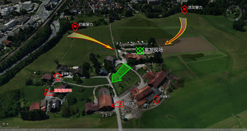 |
| Figure: Anti-terrorism situation plotting with OSGB Data as the background |
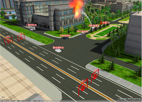 |
| Figure: Simulation plot of factory fire emergency disposal with fine Model Data as the background |
Because the core functions of 2D and 3D Plotting technology are implemented in the bottom layer, it can support a full range of products in SuperMap platform software. In SuperMap iDesktop, you can directly edit 2D and 3D Plotting.
The 2D Plotting and 3D Plotting functions will be described below.
