


3D polar coordinate modeling
Instructions for use
The function of 3D polar coordinate modeling is based on UV parameters and mathematical expressions. A variety of 3D surface models including sphere, paraboloid, Hyperbolic paraboloid, cylinder, cone, Mobius Torus, helicoid, Spiral torus and Roman surface are constructed.
Operation steps
- Right-click Datasource in Workspace Manager to open or create a new File Database.
- On the 3D Geographic Design tab, in the Rule-based Modeling group, click 3D polar coordinate modeling. The 3D polar coordinate modeling "dialog box pops up. As shown in the following figure:
- Function
- Common Functions: Provides many commonly used function types for easy use when writing mathematical expressions.
- Surface templates: Currently, various 3D surface templates are provided, including sphere, paraboloid, Hyperbolic paraboloid, cylinder, cone, Mobius Torus, helicoid, Spiral torus and Roman surface.
- Selecting a different surface template gives the corresponding mathematical expression in the text field of the expression.
- Mathematical expressions should be written by referring to the Function Description example at the lower right corner of the 3D polar coordinate modeling "dialog box.
- Parameter Settings: It includes setting the range and step of U and V, as well as the constant symbol.
- Parameters U and V: set the range and step of u and V.
- Constant table: records some constant symbols in the expression. Constant symbols must be written into the constant table, and the constant table must not contain u, V, w, X, y, Z. Constant cannot have the same name as a variable. Not Case Sensitive.
- Projection Settings: Sets the coordinate system of the Target Dataset.
- Result Data
- Insert point coordinates: Customize the value of XYZ. The default X, y, Z is (0,0,0).
- Datasource: Select Target Datasource from the drop-down list to load the first Datasource in Current Workspace by default.
- Dataset: Enter a string as the name of the Result Dataset. The default is ParameterSufaceMesh.
- Whether to include eigenvalues: checked by default. Eigenvalues can be used to express characteristics that are different from other things.
- Function Description: Notes and examples for writing mathematical expressions.
- Click OK to complete 3D polar coordinate modeling. Generates a Model Dataest named Dataset Name under the specified Result Datasource.
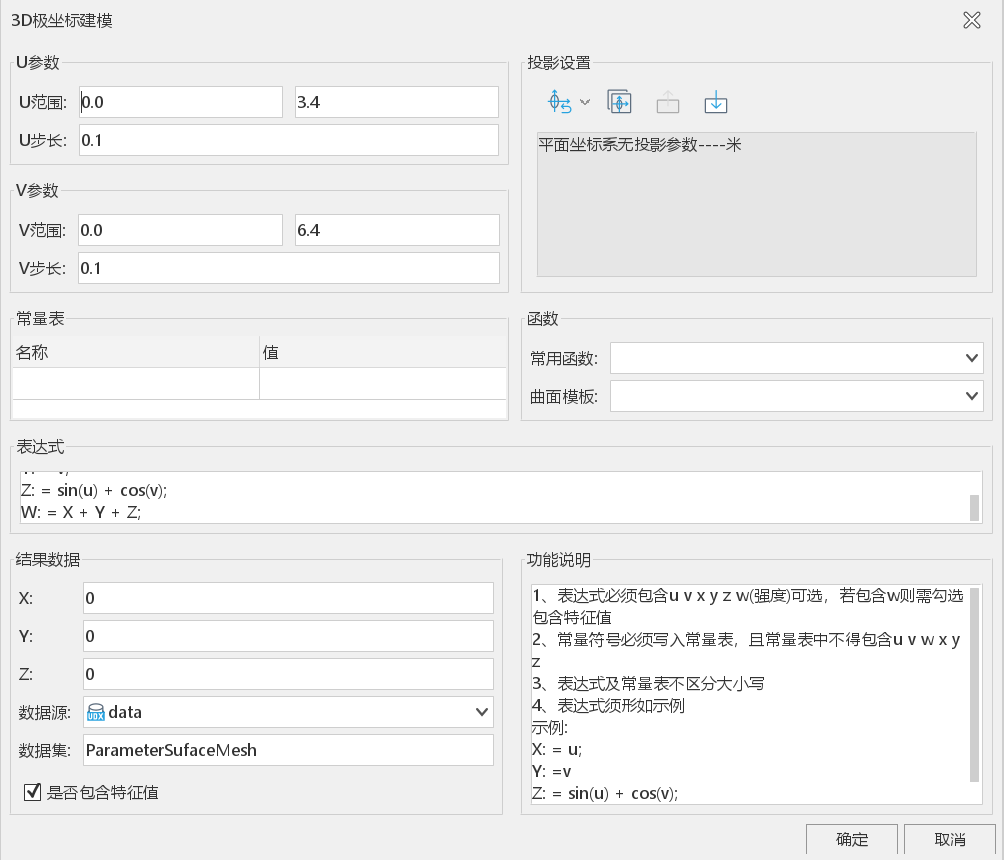 |
| Figure: 3D polar coordinate modeling "dialog box |
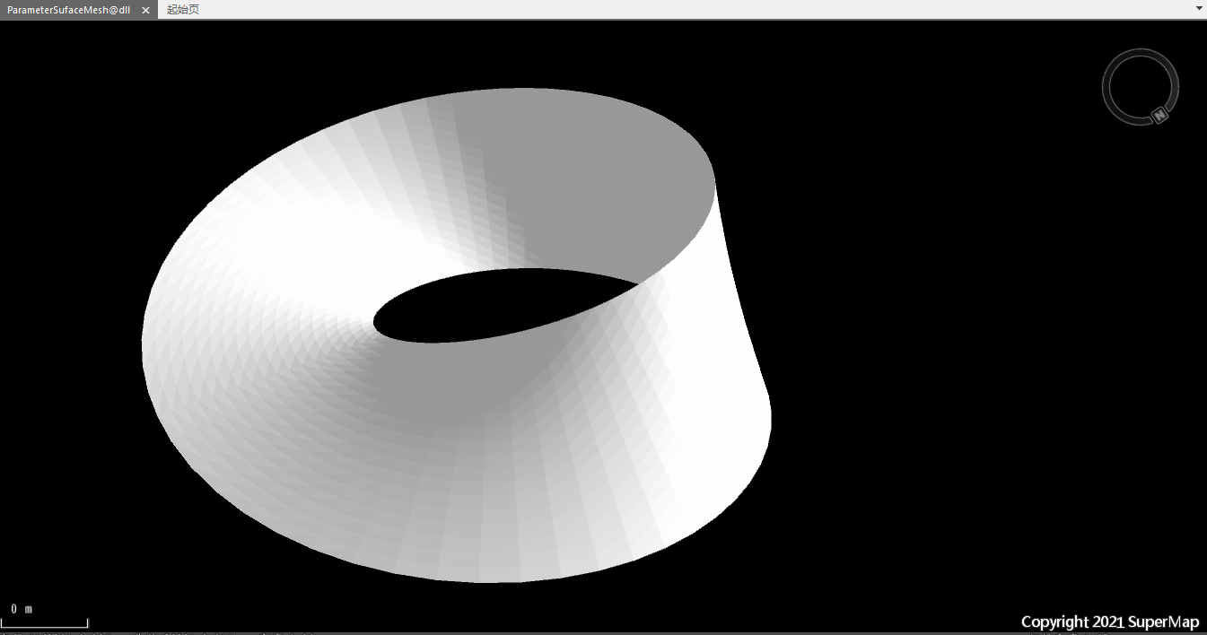 |
| Figure: "Mobius Torus" Effect Picture " |
 Precautions
- Open Datasource is required in Workspace Manager. 3D polar coordinate modeling functionality is available.
- You need to follow the example in Function Description to write the expression.