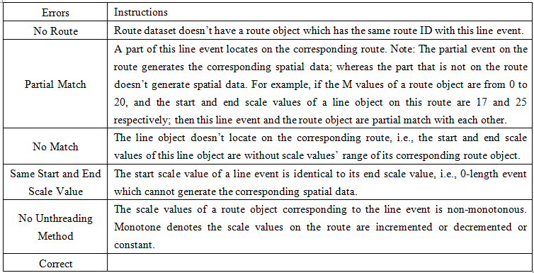
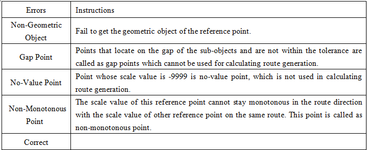
Errors field description
Instructions for use
The Errors field is directly written into the event table, and is mainly used to describe the Errors that the event fails to generate the corresponding point/line.
When you Generate Spatial Data, you typically encounter several types of errors that fail to locate successfully. If the Generate Errors field is set, after Generate Spatial Data, Application automatically adds the error field to the event table and writes the error.
- When the generated Spatial Data is point data, there are the following types of Errors:
- When the generated Spatial Data is line data, there are the following types of Errors: