


Electronic Chart, as a major technological breakthrough in the field of navigation, is of great significance to the protection of maritime safety. With the growing demand for GIS platforms in the maritime industry, The product adds support for charts and realizes the leap of Electronic Chart in the GIS industry. SuperMap products are based on S-57 and S-52 international standards, support the import and export of Chart Data model (*.000), and support the creation of charts, multiple color modes, feature Display Control, basic Map Operation, etc. On this basis, we break through the limitations of traditional charts, support the integration and release of Chart Data and land data, and truly realize the integration of land and sea.
Sea-land integrated storage
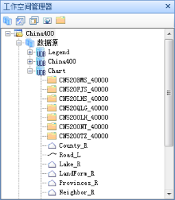
The SuperMap Chart Module stores the standard Chart Data (*.000) in the form of Dataset Group, so that the Chart Data can be unified with other GIS Datasets in terms of management and operation. There is no need to maintain the land and Chart Data separately, which greatly reduces the maintenance cost.
 |
Sea-land integrated display
Integrated display of multiple charts
When there are multiple charts in the same area, multiple charts can be added to the same Map for display, and the Application will automatically add multiple charts to achieve seamless splicing of multiple charts to meet the user's display needs. As shown in the figure below, it is the effect picture of three charts after splicing.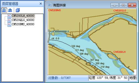
Integrated display of sea and land
The Super Map Chart Module can overlap and display the spliced Chart DataAdd to Map with the two-dimensional land map in the window, which really realizes the seamless combination of the chart and the land map, and does not need to display the chart and the land map data in the two systems respectively.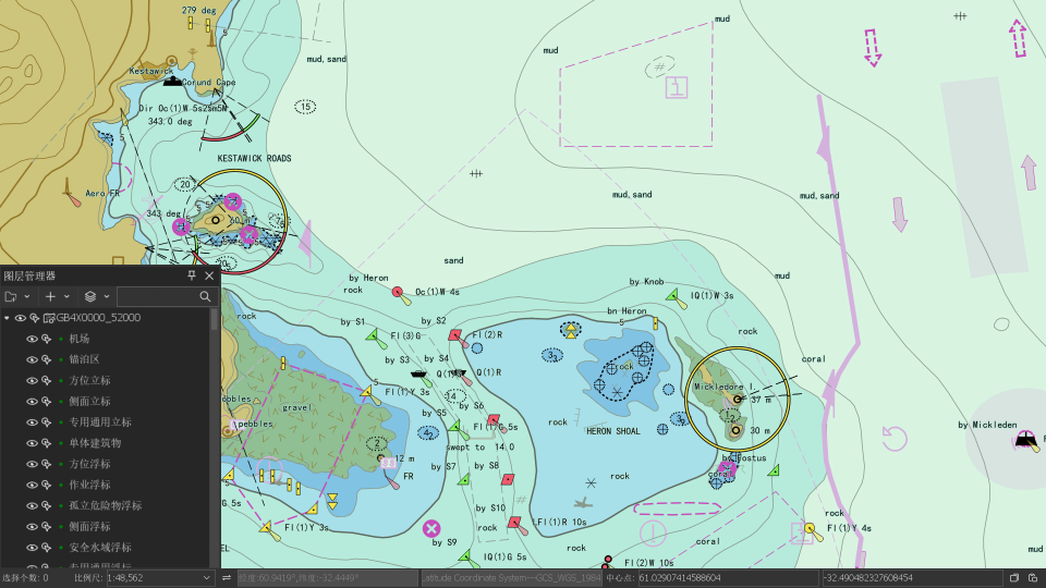
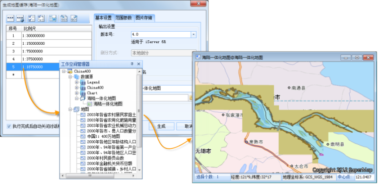
Release of Sea-Land Integration
The SuperMap Chart Module can directly publish the Publish Map Cache of the chart or the integrated map of land and sea on the server side.
 |
The success of SuperMap Chart Module in land-sea integrated storage, land-sea integrated display and land-sea integrated release has broken through the limitations of chart development and met the strong demand for the integration of chart and land map data. It provides a perfect Solution for the application of maritime transportation, maritime and land integrated emergency rescue, maritime resources and inland waterway resources development.