


Chart is a kind of map which takes ocean waters and coastal features as the main drawing objects, and provides the necessary data basis for the safety of navigation. The chart is mainly divided into general chart and special chart. The chart mentioned in this document refers to the electronic navigation chart (ENC, Electronic Navigational Chart), which is a kind of special chart.
Electronic chart is a standardized database in content, structure and format, which is specially used for Electronic Chart Display and Information System (ECDIS). At the same time, the electronic navigation chart shall be a database produced and issued by the Hydrographic Bureau authorized by the government in accordance with the Digital Hydrographic Data Transmission Standard (S-57) issued by the International Hydrographic Organization (IHO). The ENC contains all the chart information required for safe navigation, and may also contain supplementary information that is not available on the paper chart but is considered necessary for safe navigation (such as sailing directions).
Because of its industry specificity, globality and practicability, Electronic Chart needs to follow more stringent and unified specifications than general Digital Map in the production, transmission, display and modification of data. International organizations closely related to Electronic Chart, such as International Hydrographic Organization (IHO) and International Maritime Organization (IMO), have been committed to promoting the development of ENC and ECDIS for many years, and have formulated a series of specifications and standards. Including S-57 (IHO Hydrographic Data Exchange Standard), S-52 (Electronic Chart Display Standard), S-58 (Electronic Chart Validity Check Standard), S-100 ( General Hydrographic Data Model ), etc., the details are as follows:
- S-57: Digital Hydrographic Data Transmission Standard is a legally binding standard for the data exchange and transmission of electronic navigational charts in vector form.
- S-52: Electronic Chart Display and Information System Chart Content and Display Specification, which specifies the content and display of Electronic Chart, as well as the details of the use of colors and symbols.
- S-58: ENC data validation recommendation, which ensures the validity of data space and description attributes and improves production quality.
- S-100: The Common Hydrographic Data Model provides a modern marine Geographic Spatial Data standard, with the main goal of supporting more digital data sources, products and users of marine surveying and mapping.
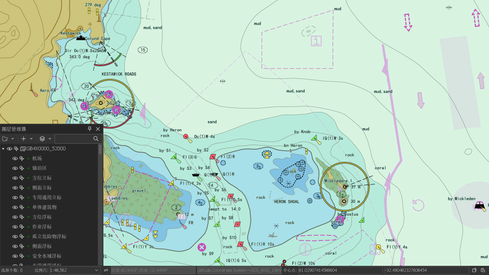
Product capability
SuperMap iMaritimeEditor is a desktop software developed based on SuperMap iDesktopX, which can be used to display and edit Chart Data. It provides Chart Data conversion, display, query, editing and data verification based on S-57, S-52 and S-58 standards, as well as data dictionary management and environment configuration, which makes it easy to build ECDIS conforming to relevant international standards. Provide S-101, S102, S104, S-127, S131 five S-100 standard series product display and attribute query.
SuperMap iMaritimeEditor provides a new platform for users to monitor ships by using charts, and has certain practical significance and technical value for accelerating the standardization construction of Electronic Chart in China. In addition, it breaks through the limitation of traditional chart "heavy water and light land", supports the integration of Chart Data and land data, enables users to operate and process charts and land charts in a unified way on the same platform, and truly realizes the integration of storage, display, query, editing and publishing of sea and land. It provides a perfect solution for the application of maritime transportation, comprehensive emergency rescue on land and sea, maritime resources and inland waterway resources development.
 |
| Electronic Nautical Chart |