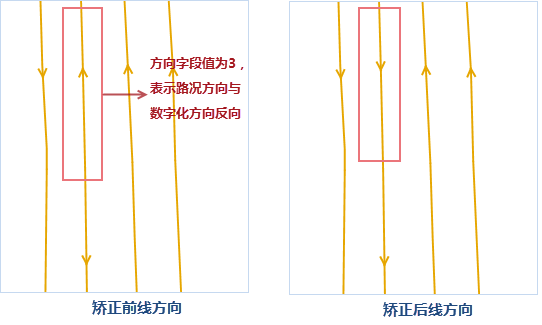
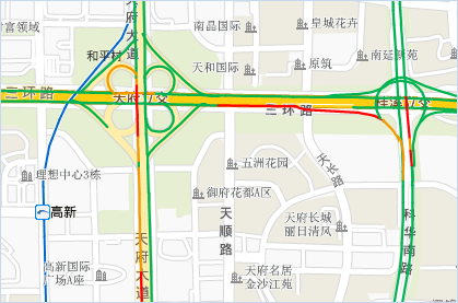
The display principle of the road condition of the double-line road is to respectively offset the two lines of the double-line road to the specified distance on both sides, and the offset direction is the right side (positive value) or the left side (negative value) of the line object digitization direction, but the user data has the same digitization direction of the two lines of the double-line road, at this time, the offset is unreasonable, and the two lines will be offset to one side, not to both sides. You need to use the "Traffic Line Correction" function to change the two lines of this double-line road from the same digitization direction to the opposite digitization direction.
The "Traffic Line Correction" function will change the source data. It is recommended to make a good backup of the data. Note: The following example comes from the field content of NavInfo data. If your data is not NavInfo data, please select the correct field according to the meaning of the field.
- In the Data Processing "group of the Data tab, click the Traffic Line Correction" in Gallery, and set the following parameters in the pop-up Traffic Line Correction "dialog box.
- Select the Road Line Data set to be corrected and the associated Select Fields in the Correct Line area.
- Start Field: The start node field of the line object.
- End Field: The end node field of the line object.
- Direction Field: The relationship between the direction of the road line and the digitization direction, and specifies the field values corresponding to the two-way, forward, and reverse roads.
- Bidirectional: indicates that the road direction has nothing to do with the digitization direction, and it is a bidirectional road, and 1 indicates bidirectional;
- Positive direction: indicates that the road direction is consistent with the digitization direction, and 2 indicates the positive direction;
- Reverse: Indicates the idea of road direction and digitizing direction. Use 3 for reverse.
- Set the Reference Point Dataset when the road direction is corrected in the Reference Point Area, and set the IDSelect Fields to match the geographical position with the Start and End Fields of the line data.
- The Assist Settings area is used to indicate the display of roads of the same type through a unified value, which is convenient for setting the display of roads in a small scale map. SuperMap uses 0, 1 and 2 to indicate the display of roads, where 0 indicates that the road conditions are not displayed, for example, the auxiliary road in a small scale; 1 indicates that the displayed road condition is a single-lane road, for example, a ramp; 2 indicates that the displayed road condition is a double-lane road, for example, a highway.
Since the data of NavInfo represents different codes for the same type of road, it is recommended to use SQL Expression when setting the road Display Type. Converts to 0, 1, or 2 based on the field value specified by Road Type and is stored in the Display Type "field. For example, it indicates that the codes of the auxiliary channel are 030 a and 060 a, and the value of the "Status" field of the corresponding object is 0.
- After setting the above parameters, click the "OK" button to correct the road alignment direction. The correction results are shown in the following figure:
 |
 |


