An Overview on Temporal Data
Temporal data is data indicating a state in time, like the land-used status in a given year.
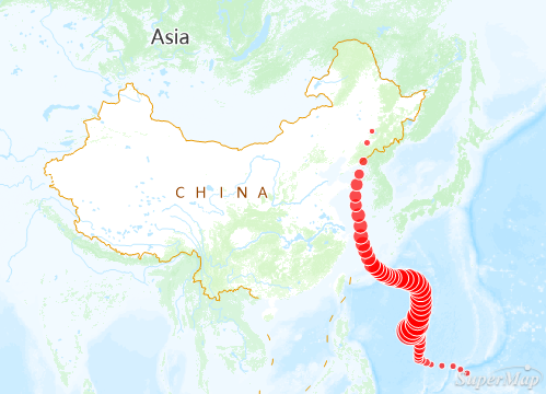
The feature of playing temporal data is to display the temporal data in your map in a certain time sequence, thereby you can view the patterns and tends of data with time. As shown in the figures below, Figure 1 shows the typhoon track point elements. The time field indicates the typhoon observation time. After setting parameters, the playback effect is shown in Figure 2.
 |
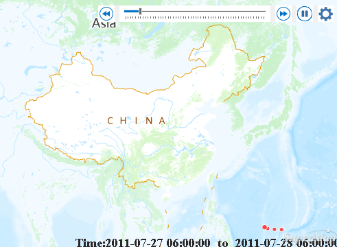 |
| Figure 1: Typhoon track points | Figure 2: Play the typhoon track points at 1-hour intervals |
To play temporal data in a map, please follow three steps below:
- Step One: Prepare temporal data
- Step Two: Enable temporal data of layers
- Step Three: Play temporal data