Data integration refers to the integrated storage and management of 2D/3D spatial data. 2D and 3D data remain integrated in the data model and data structure. GIS data is not only compatible with 2D data structures, but also 2D data has been properly adjusted to achieve all the 2D data without any conversion processing directly high-performance visualization in 3D scenes.
SuperMap 3D GIS based The OGDC standard ( Open Geo- DataBase Connectivity , Open Spatial Database Connectivity Standard) enables indiscriminate access to multiple data sources and loads different formats of data from different platforms into the same scene. The 3D scene supports various types of data as follows:
- Supports the 3D display of 2D data, that is, adding a variety of 2D geometric objects or 2D vector graphics layers to a 3D scene;
- It supports 3D data processing, 2D objects such as the 3D drawing and 3D geologic bodies and 3D plane texture mapping, 3D rendering of stretched object;
- Supports importing or adding 3D datasets, 3D geometric objects, 3D models loading onto 3D scenes;
- Support loading image data and terrain data into 3D scenes;
- Supports loading data such as map cache, vector cache, image cache, and model cache into the scene;
- Support KML file is added as a 3D layer to a 3D scene;
- Support loading screen maps into the scene, etc.
The 3D data in the 3D scene is organized as a 3D layer. That is, adding 3D data to a 3D scene actually adds data to a corresponding type of layer in the 3D scene. The 3D layer in the 3D scene can be divided into ordinary diagrams. Layers, screen layers, terrain layers, 3D tracking layers, where 3D scenes can contain multiple types of layers, and these layers are managed by a 3D layer collection, and there can be multiple terrain layers. Correspondingly managed by the terrain layer collection, the 3D scene contains only one screen layer and 3D tracking layer.
Note: Normal 3D layers are divided into five types: 3D dataset layers, 3D map layers, KML layers, image file layers, and model cache layers.
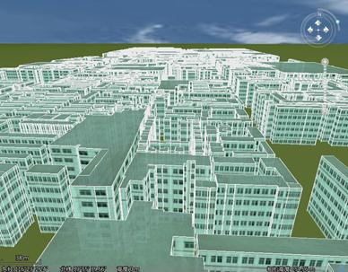 |
| Figure 1: Plane Dataset Added to a 3D scene (stretch and map) |