2D plotting is combined with the electronic map to achieve military operational plan, emergency response plan, police rounded up scheme and other command scheduling scheme plotting applications. By using meaningful graphics and labels provided on the plotting panel, it can directly and accurately show the solutions of events, improve the efficiency of consultation and communication in emergency disposal process.
2D plotting provides the symbol library which follows the industrial standards, to fully support the military, public security and armed police, emergency and other industries application requirements. The police symbol library is as shown below.
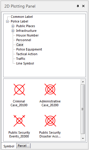 |
| Fig : 2D Plotting Panel |
The graphics can be selected, moved, zoomed in the map for interactive editing. The following picture shows how to edit a symbol.
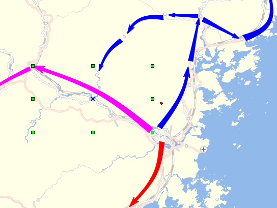 |
| Fig : Editing Lines/Regions |
When creating or opening a map window in SuperMap iDesktop, it will show the 2D Plotting tab:
Plotting Panel
Show the common symbols, police graphics, etc. When the CAD layer is editable, you can choose a symbol/graphic for drawing.
Property Panel
Show the attributes information of the selected symbol/graphic, supporting editing the attributes.