Managing Spatial Indexes
 Instructions
The Spatial Index command allows you to manage the spatial indexes for the selected datasets.
Basic Steps
- In the Workspace Manager, select the datasets whose spatial indexes you want to view or modify. You can select several datasets using Shift + click or Ctrl + click.
- On the Start tab, click Data Processing > Spatial Index to display the Spatial Index Manager.
- If you want to create a new type of spatial index for a dataset, you can set the Target Index for it, and then click Create at the bottom of the Spatial Index Manager.
- After creating or viewing the spatial indexes for datasets, you can click Cancel to close the Spatial Index Manager.
- supports r-tree index, quadtree index, dynamic index and tile index.
- UDB and POSTGRESQL datasources only support r-tree index.
- DB2 datasources only support dynamic index.
- Other database datasources support r-tree index, quadtree index, dynamic index and tile index.
- CAD datasets have no support to any dynamic index.
- Route datasets do not support tile index.
- Tabular datasets have no support to any spatial index.
The Original Index indicates the original index type of a dataset. To create a new type of spatial index for a dataset, change its Target Index in the Spatial Index Manager.
To know more about the Spatial Index Manager, please refer to the introduction to the Spatial Index Manager in this page.
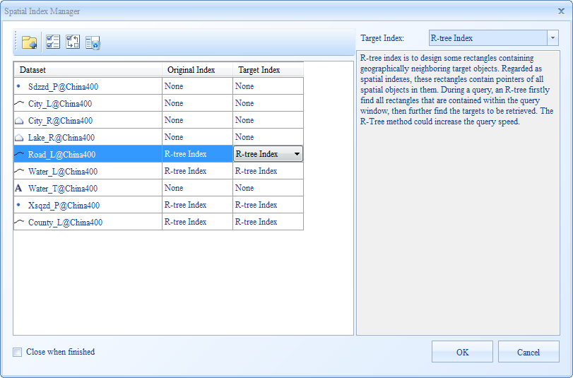 |
| Figure: The Spatial Index Manager |
 Introduction to Toolbar
 Add: Click "Add" the "Select" dialog box pops up, the spatial index information of other dataset can be added to the "Spatial Index Manager".
 Select All: Select all datasets in the list box.
 Select Inverse: Select the inverse datasets in the list box.
 Remove: Remove datasets form the list box.
 Note
Note
 Related Topics
For more information on different types of spatial indexes, please refer to Spatial Index Types.