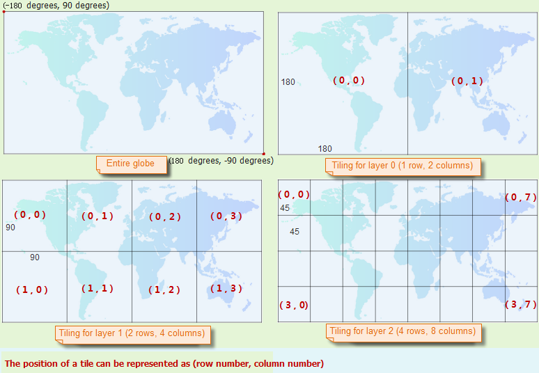
Each of the layers at different scales generated by resampling from the original image dataset has a distinct level number. The bigger the level number, the higher resolution the layer has. In this example, layer 1 has the lowest rosolution and layer 3 has the highest resolution. And layer 2 has a resolutin higher than layer 1 and lower than layer 3.
Different storage types may have different results.
- If you use Original,
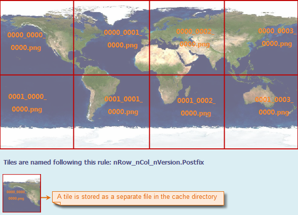
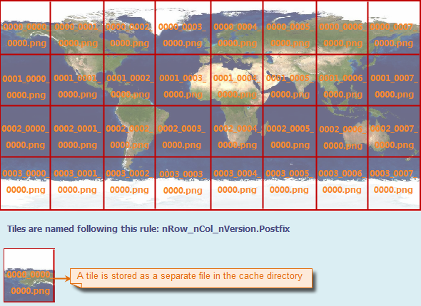
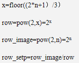
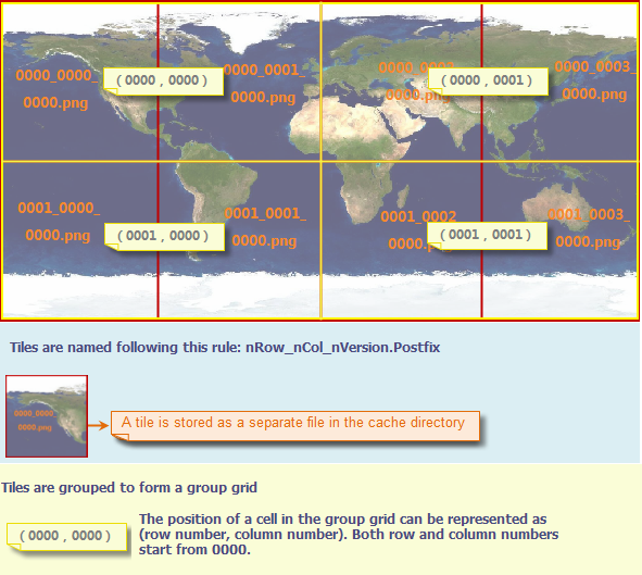
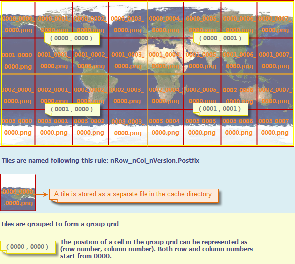
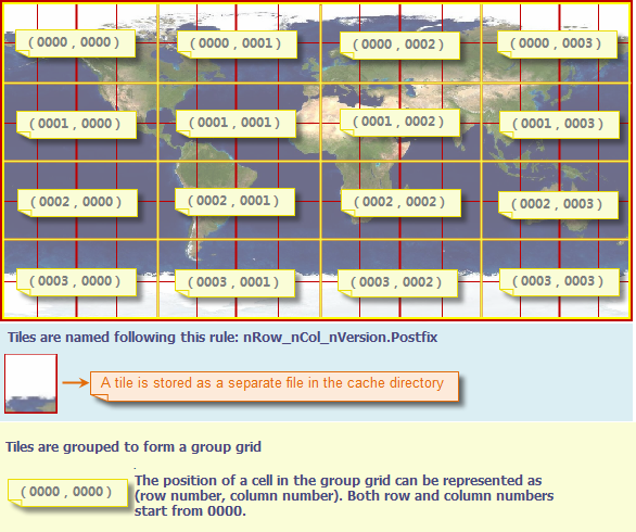
- Each of the layers is cut into tiles according to the global tiling rule in latitude and longtitude coordinate system. We call the tiled globe extent the global tile grid and each tiled layer is actually a global tile grid. Each tile is stroed as a separate file with the name in the format nRow_nCol_nVersion. Postfix
Where nRow is the row number, nCol is the column number, nVersion is the version of the tile, and .Postfix is the file extension of the tile file for image cache. nRow and nCol are both required to be 4-digit numbers. If less than 4 digits, add 0 at the beginning to make a 4-digit number. nVersion is also a 4-digit number, and it is 0000 by default. Postfix is the extension of the caches, here is *.png.
- Those caches are stored by the specified groups.
- Each of the layers is cut into tiles according to the global tiling rule in latitude and longtitude coordinate system. We call the tiled globe extent the global tile grid and each tiled layer is actually a global tile grid. Each tile is stroed as a separate file with the name in the format nRow_nCol_nVersion. Postfix
- If you use Compact
- Based on grouping, the caches are zipped and encrypted to three files, namely, Name.~,Name.sc,Name.sc00
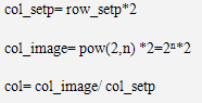
Where, Name is the root name.
- Based on grouping, the caches are zipped and encrypted to three files, namely, Name.~,Name.sc,Name.sc00
A global division rule is applied to terrain and image data of SuperMap. In this case, a bound for terrain or image data can be easily determined to a certain layer or tile. The first layer number is 0. The max number is 20.
 Tiling