Slope and aspect analysis
Slope and aspect analysis is used to analyze the slope and aspect of terrain data for a specified area. Slope is the angle between a tangent plane at a point on the earth's surface and the horizontal plane. The larger the value, the steeper it is, and the flatter it is. Aspect is the downhill direction in which the rate of change in values from each cell to its neighbors is the largest, and is a measure of the direction in which the slope changes at a location on the surface. This function is applied to terrain data, and when using it, it should be noted that the terrain data should have normals.
Slope aspect analysis is widely used in land resource management.
Operating steps
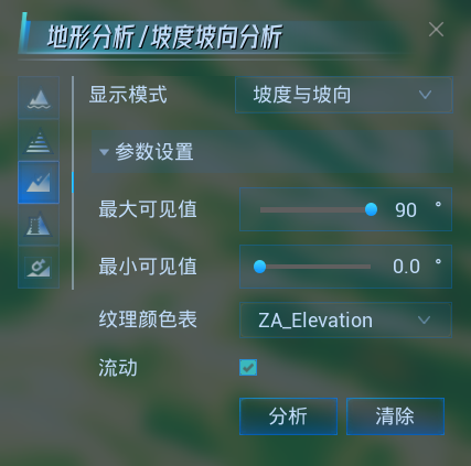
- Click the Terrain Analysis - Slope and Aspect Analysis button to switch to the Slope and Aspect Analysis Settings panel.
- The following parameters can be set before and after clicking the Analyze button. After analysis, the analysis results are modified in real time.
- Display mode: Set the display mode of analysis results, including slope, aspect, slope and aspect.
- Maximum Visible Value: Used to set the maximum slope value to participate in the analysis. Areas greater than this value are not analyzed. Modifications can be made by simply typing in values or by moving the slider bar.
- Minimum Visible Value: Used to set the minimum slope value to participate in the analysis. Areas below this value are not analyzed. Modifications can be made by simply typing in values or by moving the slider bar.
- Texture Color Table: Change the color texture table by selecting the attribute field from the drop-down menu.
- Flow: Sets whether to turn on aspect arrow flow within the analysis area.
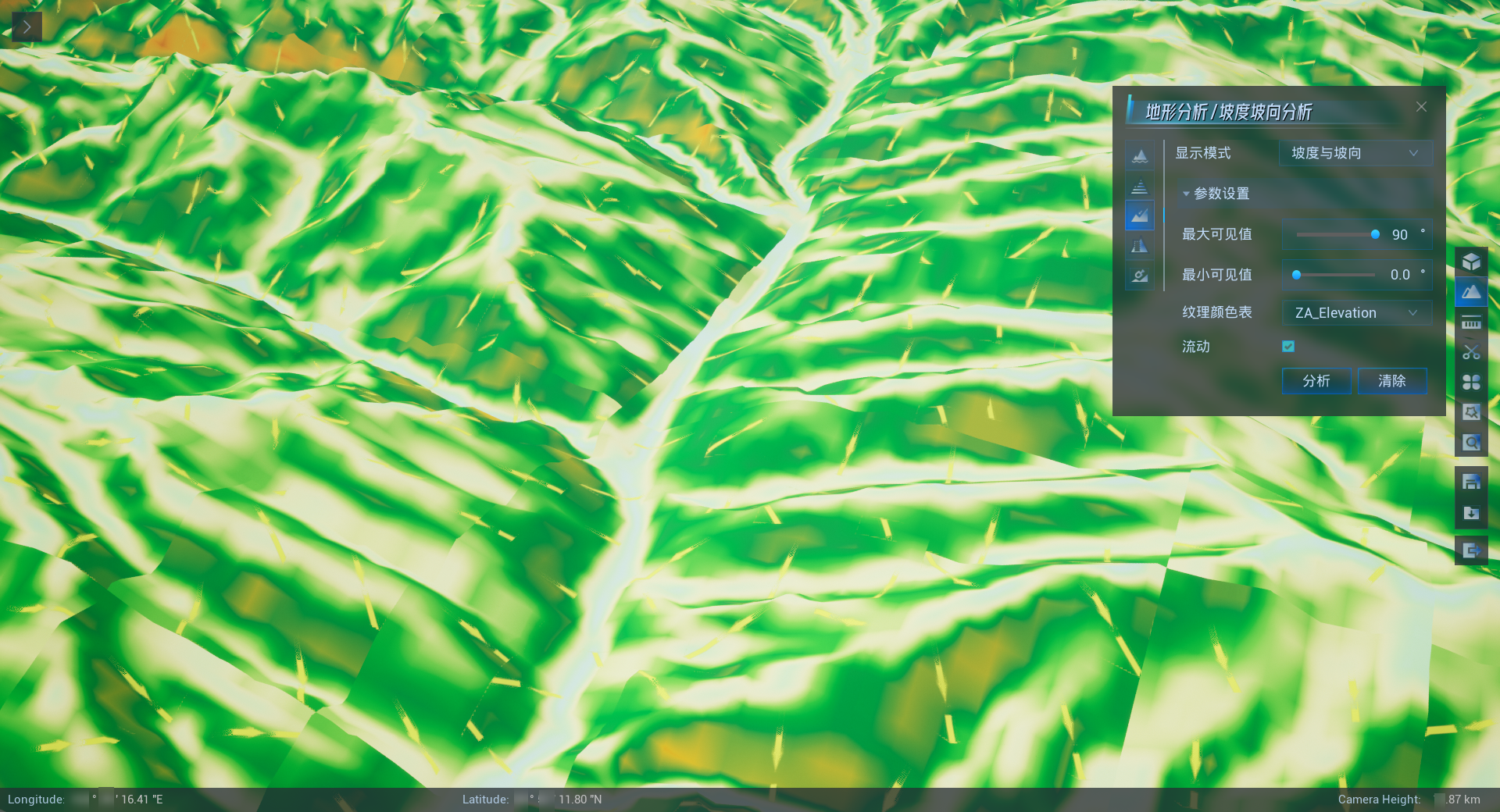
- Slope aspect analysis results are shown in the figure below.
- When the analysis is complete, click Clear to clear the analysis results from the 3D scene.


